
Check a postcode before you make an offer.
Get a property area report covering flood risk, local crime, house price growth and transport access.
Data: HM Land Registry, Environment Agency, UK Police, OpenStreetMap (TfL in London). Not financial advice.
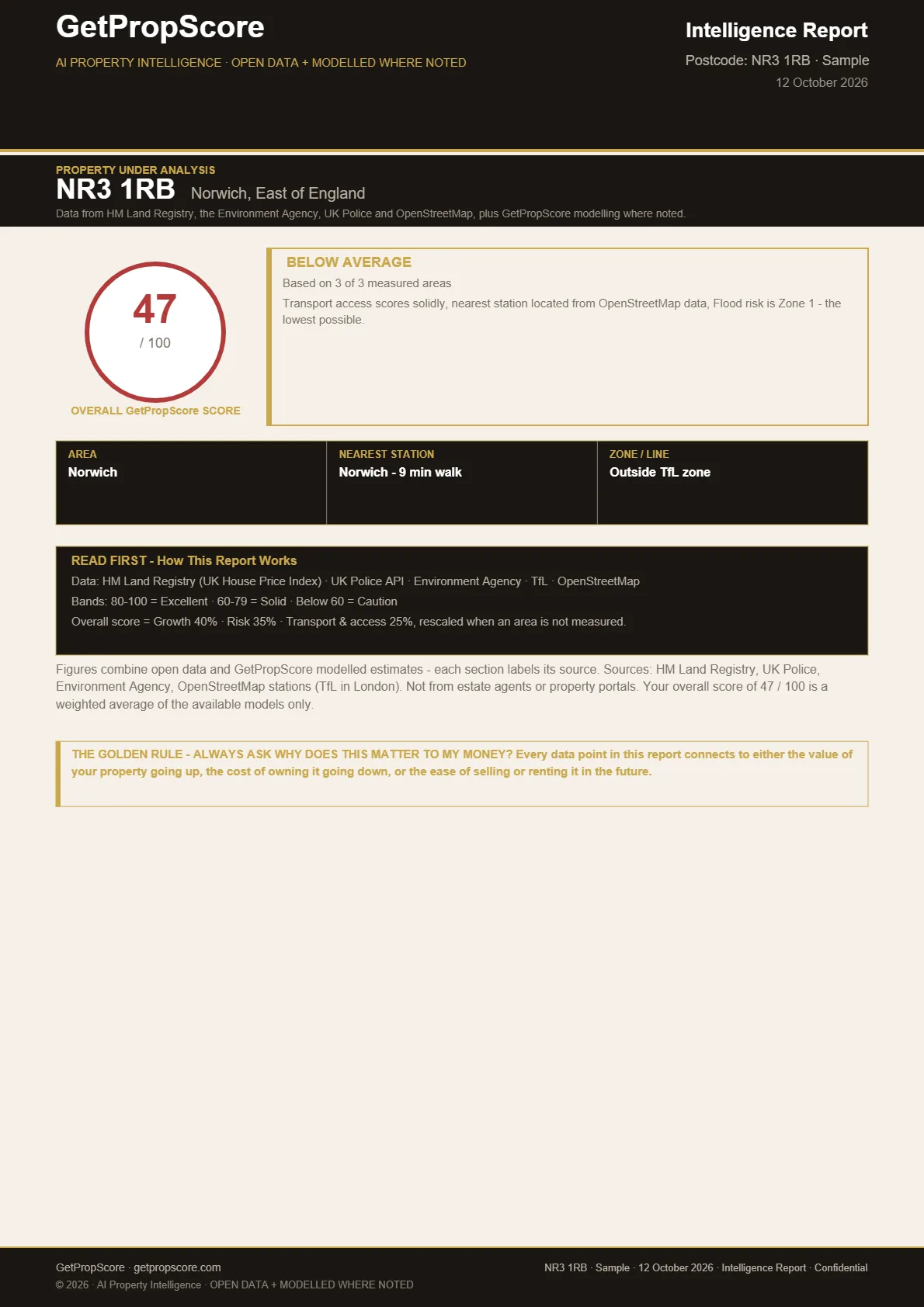
- 1. Enter a postcode
- 2. Pay £19 once, no subscription
- 3. Get your PDF report by email
Scores use data from
- HM Land Registry
- Environment Agency
- UK Police
- OpenStreetMap
What you get
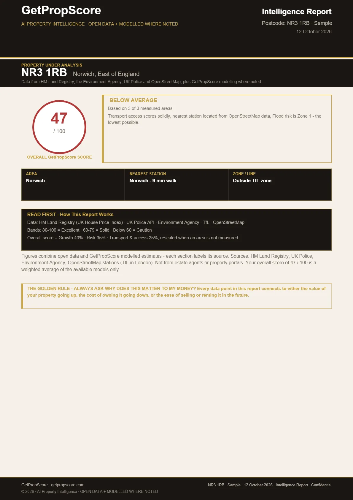
One PDF report for one postcode, emailed to you. It covers:
Flood risk
Environment Agency long-term flood risk from rivers, the sea and surface water. If the Environment Agency doesn't answer, the report says so and leaves flood out.
Crime
Street-level crime recorded within about a mile of the postcode, from UK Police data (police.uk).
Price growth
5-year change in average house prices for the council area, from the UK House Price Index, compared with England over the same months.
Transport & access
Walking time to the nearest station (OpenStreetMap). In London, the rail, Underground and Overground stops within 800 m (TfL).
PropScore: your score out of 100
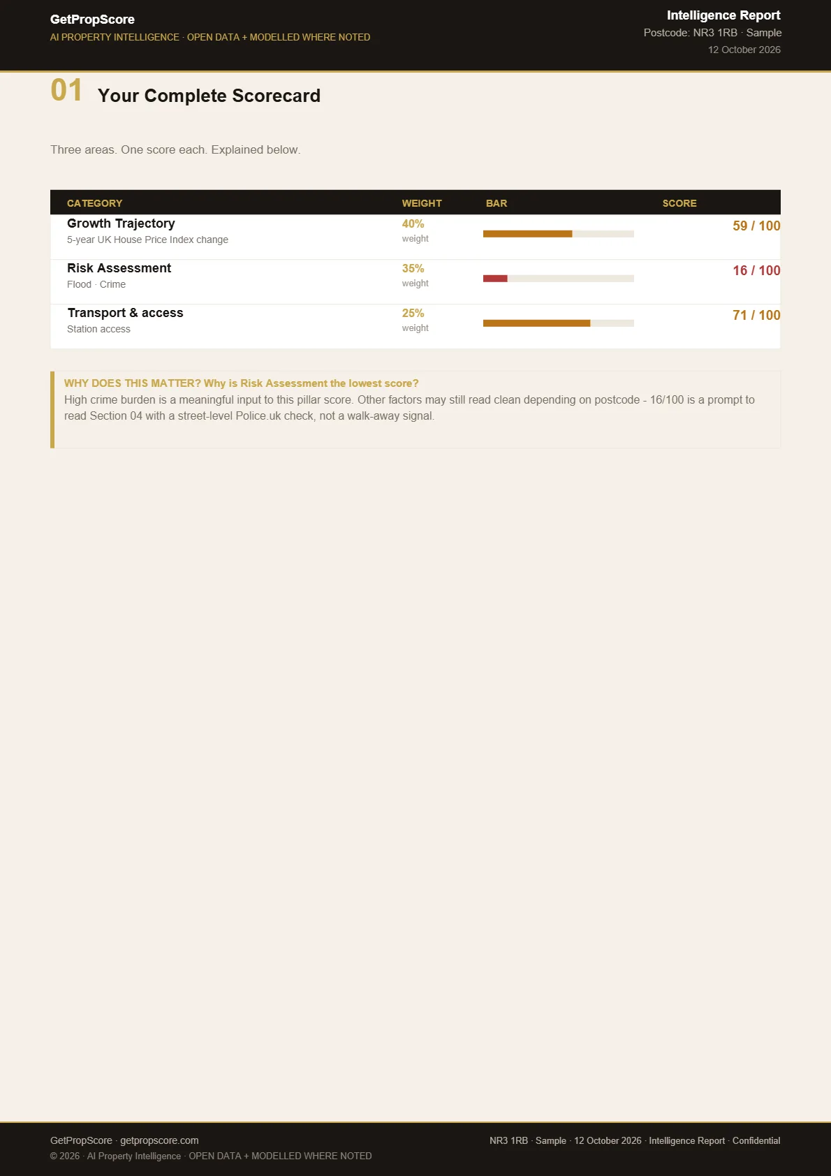
Price growth 40%, flood and crime risk 35%, transport & access 25%. An area without data is left out, the others are rescaled, and the report says how many were measured.
Your report includes a checklist of what to verify before you exchange.
Check a postcodeSample
PropScore Future™
A scenario calculator for one English postcode. If the annual growth rate changes, it shows the score with that assumption and today's flood, crime and transport. It assumes a constant growth rate.
Frequently asked questions
Clear answers to the questions buyers and investors ask most.
What is GetPropScore?
GetPropScore checks a property in England by postcode. You get a PDF report with a PropScore out of 100, weighted across price growth (40%), flood and crime risk (35%) and transport & access (25%), built from HM Land Registry's UK House Price Index, Environment Agency flood data, UK Police crime data and OpenStreetMap station data (TfL in London).
How do I check a property?
Enter a postcode in England on the homepage and click Search. You'll see what the report covers, add your name and email, then pay £19 at secure checkout. Your report is emailed to you as a PDF, usually within a couple of minutes.
What data sources does GetPropScore use?
GetPropScore uses HM Land Registry's UK House Price Index, Environment Agency flood data, UK Police crime data and OpenStreetMap station data (TfL in London). It covers England only.
Is there a free preview?
There's no free score preview at the moment. Searching a postcode is free and shows what the report covers. The full PropScore report costs £19 per postcode — one-time, no subscription, no account required.
Who is GetPropScore for?
Home buyers, property investors, and advisers who want independent due diligence on a postcode in England before making an offer.
Don't offer blind.
Check the postcode first.
Get a PDF report in your inbox for £19, usually within a couple of minutes. Built from HM Land Registry's UK House Price Index, Environment Agency flood data, UK Police crime data and OpenStreetMap station data (TfL in London). England only.